Galego
  Español
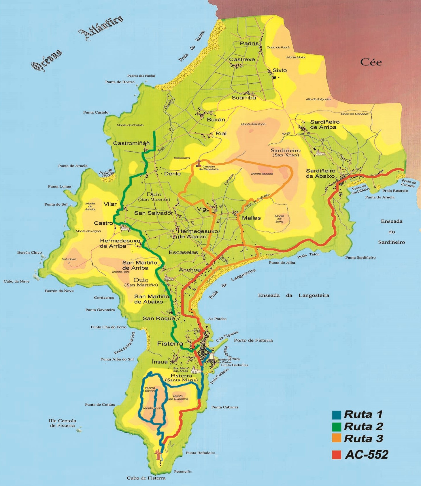
Routes
1st Route.- FISTERRA ´S CAPE

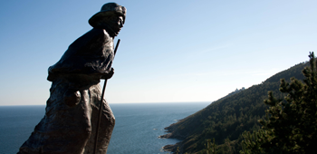
Saint William´s hermitage - Holy Stones - Fisterra´s Lighthouse
The route begins in the direction of San Carlos Castle. It is a XVIII century fortification. We continue to Santa María das Areas church, from the XII century.
After visiting the church, we beging to climb Saint William´s Mountain. We take a crossroad to the right , about 100 meters from the church. The climb continues along the forest paths taking the first junction on the right. We walk for about twenty minutes and we arrive at the second crossroad where we turn left.
After about 200 meters a small path appears on the left that takes us to Saint William´s Mountain. From here you can see one of the most beautiful panoramic views from Fisterra village.
Retourning to the previous intersection, we have to turn left, and continuing along the track that goes up to Facho Mountain. At the end of this track, we continue along another track that takes us to the Holy Stones, where we can see another spectacular views from Fisterra and its isthmus.
Returning on the path that we have travelled, we begin the descent along the paved track and we find a viewpoint and later the Fisterra´s Lighthouse.
2nd Route.- ROSTRO BEACH

We have to leave Fisterra in the direction of Atalaya street,and we take the path towards the sports centre and we turn left to enter in San Martiño de Abajo. On the left we find the climb to San Martiño de Arriba.
Once we reached the village, we have to take the fisrt turn to the left until we reach Castro de Duio. We have to take the road that leads to Vilar and we cross the village towards Arnela Beach and without ever leaving this road we reach Denle. From there the route goes to Castromiñán. We continue along the road and we reach Rostro Beach.
3rd Route.- SEOANE MOUNTAIN

We have to leave Santa Catalina Street. We take the first village exit towards Langosteira Beach and we walk along its seafront. Next, we take a paved track that takes us to the AC-552 road, which we must cross in Calcoba area and then we continue along a small path that takes us to Mallas village.
Once at this point, the path goes to the church first and then to the old school. From here we travel about 150 meters. At the crossroad, the route turns left to go directly to Seoane Mountain, that its the highest mountain in the municipality.